Clackmannanshire pupils put walking on the map
School pupils and their families across Clackmannanshire are being supported to get more active on the journey to school with a series of new maps.
The ‘Active Travel Zone’ maps have been created by Living Streets Scotland – part of the UK charity for everyday walking – in collaboration with Clackmannanshire Council’s Transportation team. It is hoped they will encourage more families to walk or wheel their journey to school by showing the walking distance from local streets, transport hubs and ‘Park and Stride’ sites.
Park and Stride allows families to park a short distance away and walk the rest of the way to school, helping to reduce congestion, road danger and pollution outside the school gates.
The first map launched at Alva Primary School (18 September) with pupils at the school joined on a walk from the new ‘Park and Stride’ sites by Councillor Graham Lindsay before sharing in a breakfast together.
Maps have also been created for Craigbank Primary School, Menstrie Primary School, St. Serf’s Primary School and Sunnyside Primary School, with launch events taking place throughout International Walk to School Month in October.
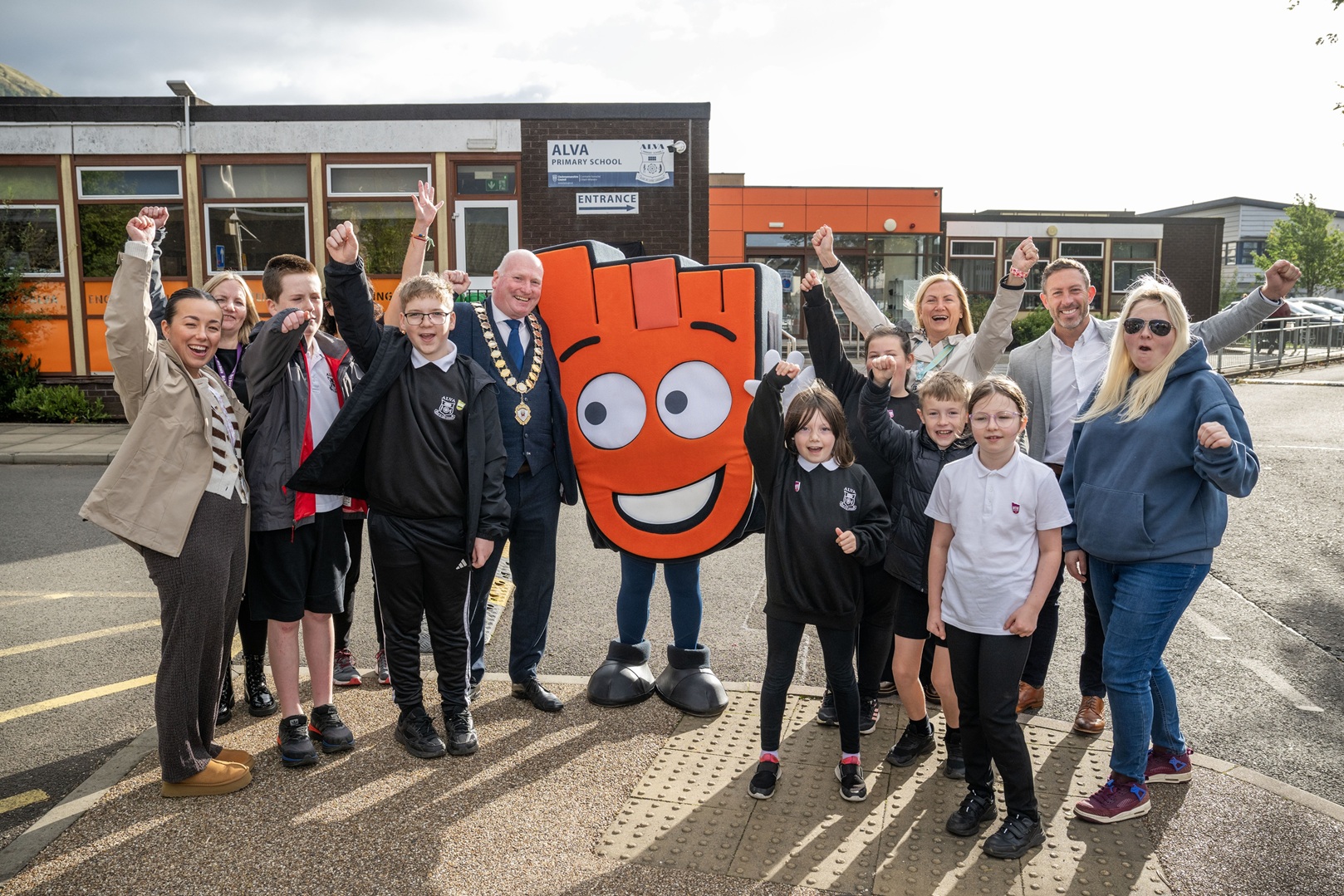
Alva Primary School pupils and school staff are joined by Cllr Graham Lindsay; Cllr Fiona Law; Provost of Clackmannanshire Council, Donald Balsillie; and Living Streets’ mascot, Strider to launch the map. (Image: Clackmannanshire Council/Lesley Martin)
Councillor Graham Lindsay, spokesperson for Place, said:
“I was delighted to join the Alva Primary school community at the launch of the Active Travel Zone maps. The Council is focused on working with schools, parents and communities to encourage more people to cycle, walk and wheel on short everyday journeys.
“These new Active Travel Maps support that work by showing parents and children the safest and most accessible way to get to school. Choosing a healthier and cleaner way to travel will help improve road safety, reduces congestion and aligns with the Council’s Climate Emergency priorities.
“This partnership with Living Streets is just one part of a whole host of sustainable travel initiatives we are delivering in schools and the wider community.
“Currently our Active Travel public consultation survey is live, and we are keen to hear from as many people as possible so future initiatives can continue to meet the needs of our community.”
All five schools take part in WOW – the walk to school challenge from Living Streets Scotland. WOW sees pupils record their journey to school on the interactive WOW Travel Tracker and rewards those who walk, wheel, cycle, scoot or ‘Park and Stride’ to school with a WOW badge.
Over 150 primary schools in Scotland take part in WOW and see on average a 5-10 per cent increase in pupils walking to school with a corresponding drop in car use.
39 per cent of pupils at Alva Primary School are currently walking to school. The charity hopes that the maps will support even more children to walk to school.
Chris Thompson, Programme Manager, Living Streets Scotland, said:
“We know from our work in schools across Scotland that families can be put off walking to school because they don’t know the safe and accessible routes available. We hope that these maps will support even more children and their parents and carers to choose cleaner and healthier ways to travel to school, helping to improve road safety and reduce congestion for the whole community.”
The maps have been produced as part of the Walking Nation project, made possible thanks to a People and Place grant. People and Place grants are funded by the Scottish Government and are administered and supported by SEStran.
Sandra Lavergne, Project Officer at SEStran, said:
“The Active Travel Zone maps are a brilliant resource for encouraging more people to walk, wheel, and cycle. We’re proud to support this initiative through our People and Place programme. These maps will make it easier for families to identify safe, accessible routes, helping to reduce car traffic around schools and contributing to a healthier environment and improved wellbeing for everyone.
“We’re excited to see the difference they’ll make in how children and their parents and carers travel to and from schools across Clackmannanshire.”
The maps can be viewed online at https://www.clacks.gov.uk/learning/saferroutestoschool/
About the author
Kathryn Shaw
Head of Communications and Marketing, Living Streets / [email protected]